
NASA Deploys Advanced Radar Technology to Map California's Hidden Water Resources
NASA is using sophisticated radar technology aboard a Gulfstream-III aircraft to track underground water movement in California's San Joaquin Valley. The groundbreaking project aims to help water managers better understand and protect groundwater resources vital for agriculture and communities.
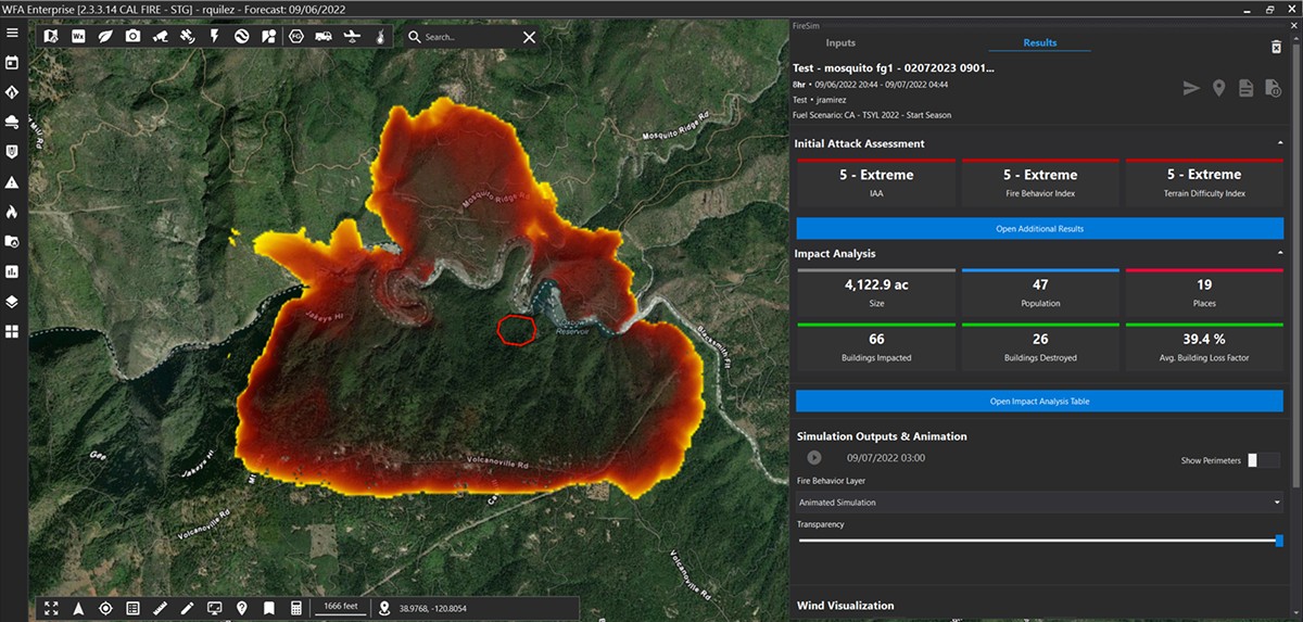
NASA's Revolutionary Wildfire Detection System Takes Flight Over California
NASA successfully tested an advanced thermal imaging instrument called C-FIRST to monitor California wildfires with unprecedented precision. The innovative technology, developed by JPL, could transform wildfire detection and research by capturing both active flames and smoldering areas simultaneously.

Spectacular Seven-Planet Alignment Visible in Southern California Skies
A rare celestial event featuring all seven planets in our solar system will be visible this Friday after sunset. While some planets like Venus and Jupiter will shine brightly, viewers may need optical aids and dark skies to spot the complete lineup.
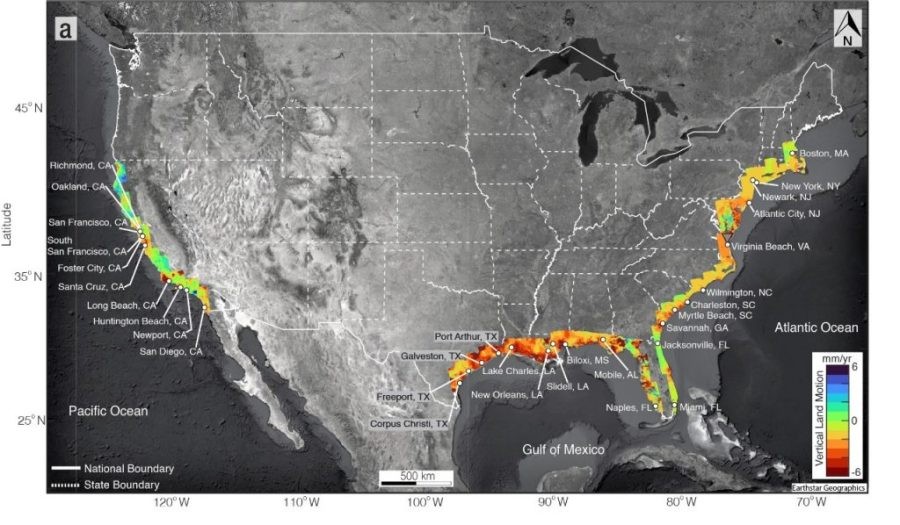
NASA Study Reveals Alarming Land Subsidence Patterns Across California's Coast
New NASA mapping research exposes concerning patterns of sinking land along California's coastline, with some areas dropping over 0.4 inches annually. The findings suggest sea level rise impacts could be more severe than previously estimated, potentially reaching 17 inches by 2050 in vulnerable regions.
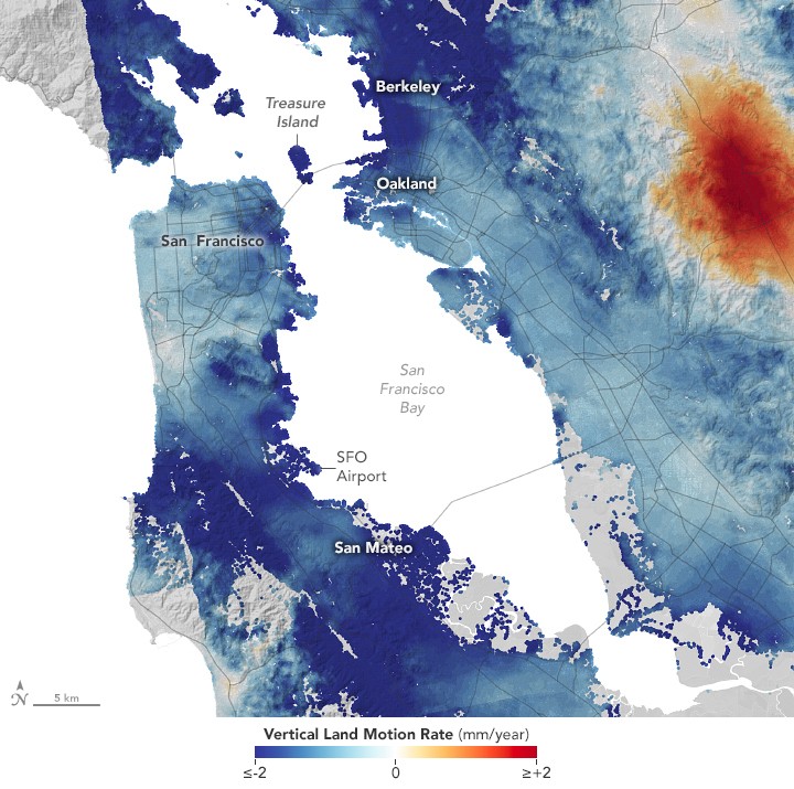
NASA Study Maps Shifting Coastal Ground in California, Revealing Future Flood Risks
New research from NASA's JPL and NOAA has mapped detailed patterns of rising and sinking land along California's coast using advanced radar technology. The study provides crucial data to help coastal communities prepare for combined threats of ground movement and sea level rise.
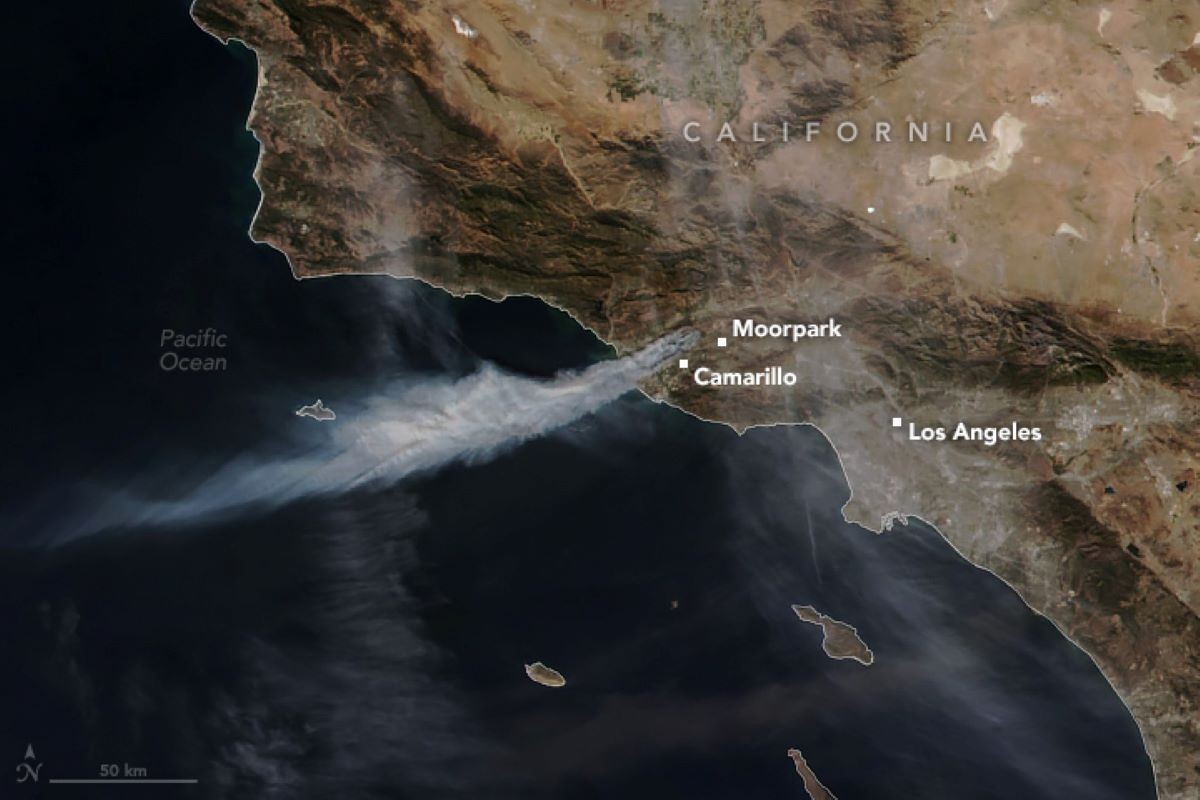
NASA Satellite Captures Alarming Spread of California Mountain Fire
A NASA satellite image reveals the extensive smoke plume from the California Mountain Fire, which has engulfed over 20,000 acres. The blaze, fueled by Santa Ana winds, has prompted evacuations and a state of emergency declaration in Ventura County.